
Subscribe
Alert Me when new Data Products are available


↓ Features
↓ Variables
↓ Geography
↓ Methodology
1990 Long Form in 2020 Boundaries allows users to access US Census data from 1990 and easily compare it with the 2020 Census data. It is the finest source of Census data from 1990 expressed at all of the 2020 ACS geographies. The 1990 Long Form in 2020 Boundaries is based upon the long form (STF 3): questions answered by one in six households in the 1990 census. It includes detailed demographic data about topics such as population, household structure, income, poverty, education level, employment, housing costs, immigration, and other variables. The 1990 Long Form in 2020 Boundaries is an invaluable resource for policy makers, community organizations, and researchers who want to analyze the changes that have occurred in the U.S. from 1990 to 2020.
Why Normalize 1990 Data to 2020 Geographic Boundaries?
Geographic boundaries change from census to census based on many factors. In the example below Williamson County, Texas is shown broken-out at the census tract level. At a glance, one can observe that there are changes in the census tracts from 1990 to 2020. In fact, Williamson County split tracts into multiple parts, with the overall number of tracts growing from 46 to 135 tracts.
| 1990 Williamson County, TX Total Census Tracts (46) 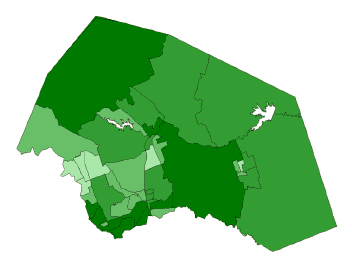 |
2000 Williamson County, TX Total Census Tracts (64) 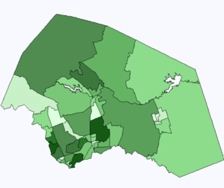 |
| 2010 Williamson County, TX Total Census Tracts (89) 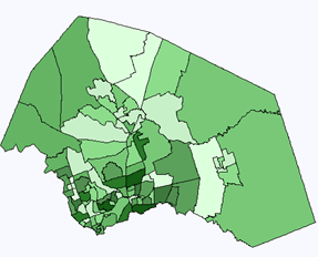 |
2020 Williamson County, TX Total Census Tracts (135) 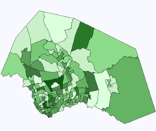 |
